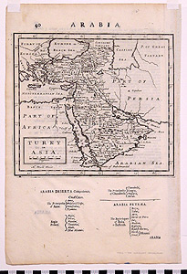
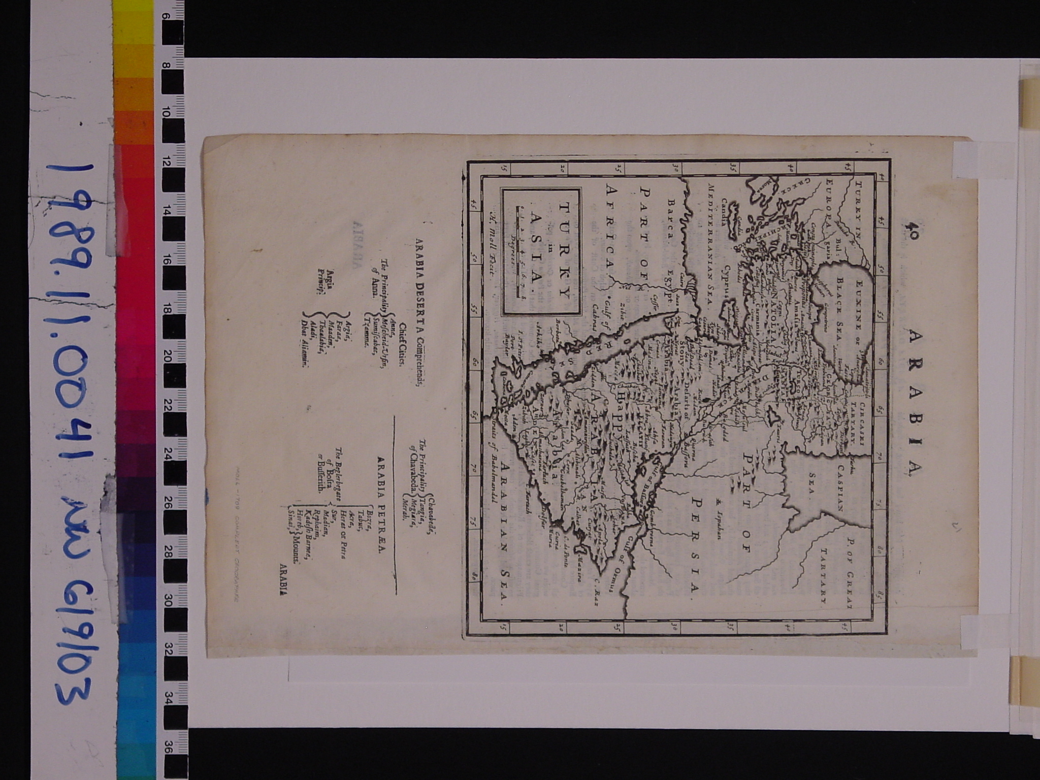
Map: Turkey in Asia
1989.11.0041
Detailed Images
Basic Information
| Artifact Identification | Map: Turkey in Asia (1989.11.0041) |
|---|---|
| Classification/ Nomenclature |
|
| Artist/Maker | Moll |
| Geographic Location | |
| Period/Date | 1709 CE |
| Culture | British, English |
Physical Analysis
| Dimension 1 (Width) | 31.6 cm |
|---|---|
| Dimension 2 (Height) | 25.2 cm |
| Dimension 3 (Depth) | <0.1 cm |
| Weight | 130 g |
| Measuring Remarks | Weighed in protective plastic cover, paper frame, and backing board. |
| Materials | Paper--rag, Pigment--ink |
| Manufacturing Processes | Printed |
| Munsell Color Information | natural (5y8/1) -ns black ( 5y2.5/1) -ns Yellowish Gray (5y 8.5/2) - background (through plastic) Dark Grayish Olive (5y 2/2) - shorelines (through plastic) |
Research Remarks
| Published Description | The notes on the back of the map are interesting for their explanations of the map. "Happy Arabia" (Arabia Felix) is an interesting denotation on the map. Donor File goes on about the Tulip Period of Ahmed III's reign; contemporaneous with the map. |
|---|---|
| Description | N/A |
| Comparanda | N/A |
| Bibliography | N/A |
Artifact History
| Archaeological Data | N/A |
|---|---|
| Credit Line/Dedication | The Seymour and Muriel Yale Collection of Coins of the Ottoman Empire and Other Middle East States |
| Reproduction | no |
| Reproduction Information | N/A |